By Emily Rothe of the University of Vermont
First research expedition in the books – heck yeah! This was our longest trip of the program and it’s gonna be a hard one to beat! We collected seeds, removed invasive plants, and surveyed 50 km of trail through Parque Nacional Patagonia from Jeinimeni to Chacabuco. Along the way, we were left starstruck by some of the most amazing views planet earth has to offer and bonded so much with each other and our surroundings. It was truly a trip to remember.
Car Camping!!
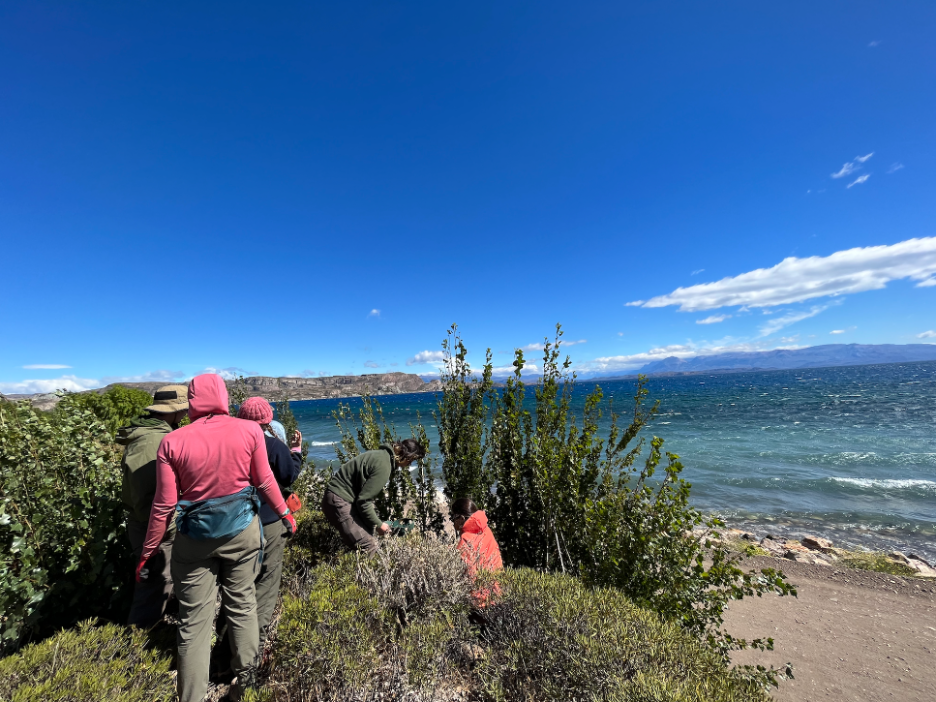
We started our journey driving about five hours from our home base in Cochrane to Chile Chico, where we spent our first night of the trip at a campground run by instructor Maria Paz’s family. That evening, we learned all about the history of Patagonia from its geologic formation to the lives of indigenous groups to colonization with Maria Paz’s father, slurped up a big pot of yummy soup, and relaxed in a wood fired hot tub that was – get this – really hot. In the morning, we packed up our tents and drove a few minutes to the coast of Lago General Carrera to our first seed collection site. We collected the seeds of Colliguaja integerrima, Ephedra fruitiosa, Phacelia secunda, and Oenothera for our friends at Huerto Cuatro Estaciones, a regenerative farm studying native seeds, and CONAF, Chile’s forest service. We then drove between two and thirty minutes to our next seed collection site, a sandy, arid roadside, where we collected more seeds, including Schinus Marcandii. We then passed the seeds onto Maria Jesus and Vanya at Huerto Cuatro Estaciones. Because little is known about the native plants in the Aysèn region and how to propogate them, they are creating a native plant nursery with the seeds we collected in an effort to repopulate native plants in towns. The work they are doing at the farm is super cool and we are so excited to be able to help them out!
From the second seed collection site near Chile Chico, we drove another hour to our next car camping site in the Jeinimeni sector of Patagonia National Park. We spent the next two days removing invasive species along trails near our campsite. On the first day, we focused our efforts on removing Pinus contorta, more commonly known as Lodgepole Pine in the United States. I have to say I never thought I would find myself ripping pine trees out of a national park but alas. Although pine trees are an integral part of many U.S. ecosystems, they are an invasive species here so as part of our collaboration with CONAF, we went to town removing them in any way we could. Pines make the soil more acidic, which can be harmful to the native plants here. The smaller ones were super satisfying to rip out of the ground with our bare hands, but the more mature ones required a bit more work (cue the saws). We cut down some sizeable pines that would make good Christmas trees come December and had a lot of fun doing it. Even though we had a fat stack of downed trees by the end of the day, there was no way for us to remove all of them so it remains an on-going process.
One could say that our second day of invasive species removal was a little heavier on the type two fun. That day, we were tasked with removing Rosa rubignosa, or rosehips. If you’ve ever removed a rosehip bush, you’ll understand why it was a bit less enjoyable than removing pine trees. They’re some pretty hardy shrubs with sharp, hooked red thorns and those plants are out for blood, let me tell you. Rosehips were originally brought to Chile by colonizers for cosmetics, but now they are all over a national park they have no business being in. We started out removing a few smaller rosehip bushes and then we walked farther down the trail only to realize that the ones we had just painstakingly removed paled in comparison to what lay ahead. We got to work with thick gloves, shovels, axes, saws, and a root ripper. A couple of hours later, we had turned that bush into a few stumps poking out of the ground. Invasive plants act as competitors to native plants, so by removing them, we are helping to conserve the native species in the national park.
LACing and Backpacking
What is LAC?
Our first research project of the semester is our Least Acceptable Change (LAC) project in collaboration with CONAF. Now you might be asking “What is ‘least acceptable change?”. With so many tourists recreating throughout the park, the trails and surrounding areas take a beating. The goal of the LAC project is to determine the least acceptable (think bare minimum) amount of change we can make in order to conserve the park by surveying the trails and campsites we travelled through on this trip. Thoroughly surveying 50 km of trail while backpacking is tedious work, but luckily for us, we have two groups this semester to cut our workload in half. Group one (our group) started in the Jeinimeni sector of Patagonia National Park and hiked south toward Chacabuco on the Cruza del Aviles trail. Group two took the reverse route. Each group surveyed on the second and fourth days of the trip so that every section of trail was surveyed. To do the surveying, we used a GPS while walking and stopped every 500 meters to record the trail condition (i.e. trail width, depth, and ground cover type). We also stopped every time we encountered a social trail (an impacted area caused by visitors wandering off trail), trail infrastructure (such as bridges), viewpoints, river crossings, and indicator species.
LAC Trip Day 1 (Non-Surveying Day)
In the days leading up to our departure, the Aysèn region experienced a significant amount of rainfall. This wouldn’t have been an issue for us (we are very strong and tough) except for we had a major river crossing to do halfway through our first day. If the water was too high and the current too strong, we would be unable to cross the river in order to continue on our journey. CONAF had closed the route to tourists because of their concerns about the crossing, so we were worried that we might have to start a day later than we had planned. We drove our pickup truck on the special road meant for rangers all the way to the river stemming from Lago Verde, where we needed to cross. Our brave leaders tested out the crossing to make sure it was safe before giving us the all clear. So naturally we took our pants off and crossed the river in groups of three in our underwear. The wind was strong that day so we were a bit chilly but our laughter kept us warm. After the crossing, the rest of the 10 (give or take) kilometers went by smoothly – and we only had to take our pants off one more time!
LAC Trip Day 2 (Surveying Day 1)
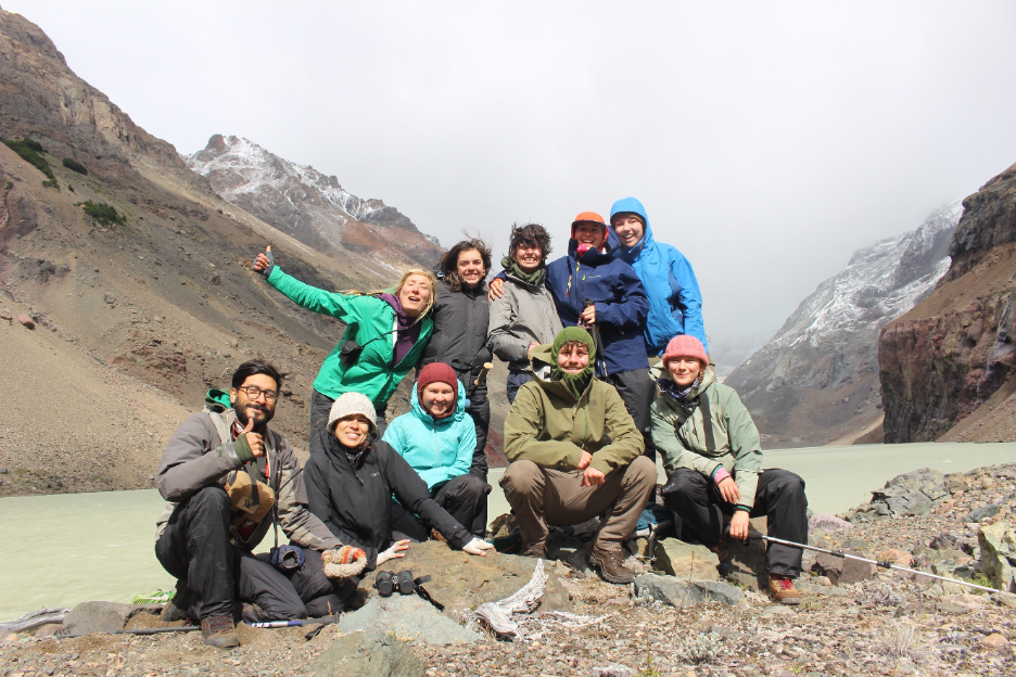
Day two offered some more intense conditions to say the least. A little heavier on the type 2 fun than the rest of the trip, but still an amazing and unforgettable experience. For the first half of the day, we were surveying the river valley in cold, windy, and rainy conditions. That kind of weather paired with crossing knee-high glacial rivers is a recipe for hypothermia, so to prevent our group from getting colder, we ducked into a forest to boil water and warm ourselves up. After lunch, we decided that the stop and go was not the best for keeping body heat up so two brave people from the group who were a little better at thermoregulation kept going with the LAC surveying while the rest of us kept hiking to the campsite. The weather also perked up after lunch and the rest of the day was awesome. We even saw two Austral parakeets in a tree right next to the trail! That night, we shared a campsite with group 2 – it was a crowded tenting site for sure but it was so fun to swap stories. In total, we hiked somewhere around 7.5 km that day.
LAC Trip Day 3 (Non-Surveying Day)
On day three of our hike, we wove in and out of lenga forests and the rocky valley of the Rio Aviles. We also took a packs-off side hike through up to a beautiful green lagoon that drained into the Rio Aviles. Then we continued on our hike to camp after lunch. We interviewed a few hikers about their experience on the trails for our LAC project on the way and arrived at our meadowy campsite around 6:00. While Clau cooked us a delicious peanut noodle curry for dinner, we frolicked in the meadow under the pink and orange sky, doing headstands, cartwheels, airplanes, and even a nine-person human pyramid! The stars that night were outstanding and I had one of the best sleeps thus far in the program. It was a great day for sure.
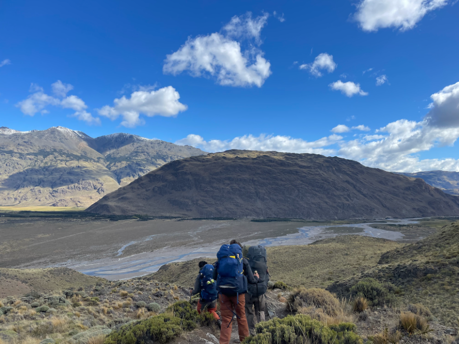
LAC Trip Day 4 (Surveying Day 2)
Our last day of the Jeinimeni-Chacabuco LAC trip was our longest with around 17 km of hiking/surveying. But that last day had some of the best views of the entire trip under a beautiful sunny sky. The trail split into two – an east side and a west side of the valley – so one group went east for surveying and the other went to the west. The hike was mainly through shrublands with mountain views in all directions and a river through the middle. We got to cross a super sick suspension bridge across the Rio Aviles that reminded us of the bridge in Shrek. We also spotted our first guanaco which was very exciting because we had heard so much about them. The east and west surveying groups met up at the end of a successful trip at the cars (Big Bertha and Blanquita) in Chacabuco and we drove back to Cochrane for dinner (at a restaurant!). On to the next adventure!